
Your growth partner in business training, local marketing, and workshops.
We focus on real outcomes, boosting skills, building local visibility, and helping businesses thrive with expert guidance every step of the way.
Get Started Today
We focus on real outcomes, boosting skills, building local visibility, and helping businesses thrive with expert guidance every step of the way.
Get Started TodayWe provide expert led business training, strategic marketing services, and engaging workshops that empower Port Phillip businesses to grow, innovate, and stay competitive, offering practical tools, personalised guidance, and local expertise tailored to meet real world business needs.

Give your team the skills they need for productivity, collaboration and leadership. Our training programs are intended to boost self esteem and enhance routine business operations in a variety of sectors.

From social media to branding, and content creation; we develop realistic marketing plans that boost exposure, attract clients and promote business growth in the Port Phillip area.

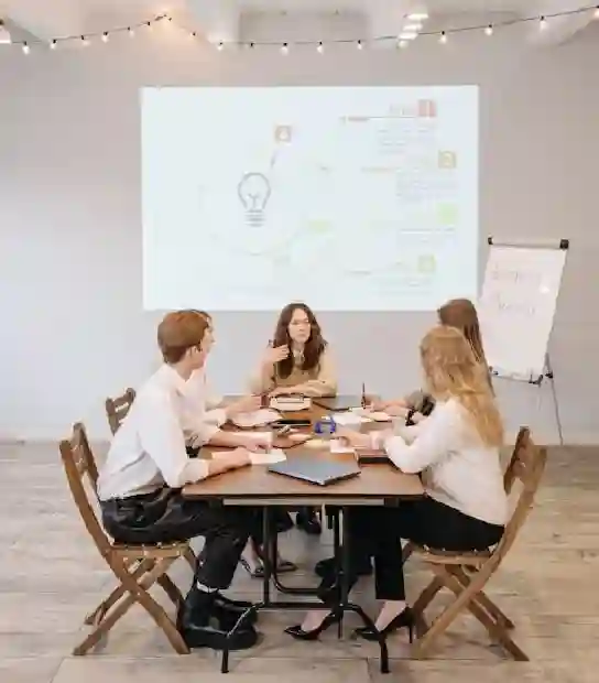
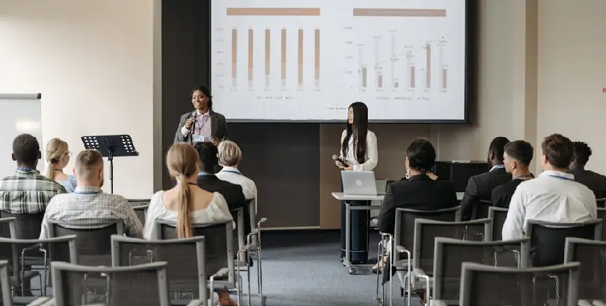
Participate in engaging workshops addressing important business subjects that are led by professionals in the field. Our interactive, thought provoking seminars are perfect for owners, teams, and local business owners looking to expand.

We offer one on one mentoring to help business owners overcome challenges, set goals, and make smart, strategic decisions that align with their long term success and local market needs.
With nearly a decade of hands on expertise, Port Phillip Business Training & Marketing is committed to assisting businesses in their growth. We concentrate on practical, results driven solutions, including expert led training, clever marketing techniques and engaging seminars customised to real world requirements. Over the years, we have worked with countless startups and established businesses in the region providing counsel that has measurable impact. Because of our extensive knowledge of the local landscape, we are more than just service providers; we are also your growth partners. Allow us to assist you in developing the skills, confidence, and plan required to propel your organisation forward.

We begin with a free one on one consultation to learn about your business, challenges, and future goals. This initial stage allows us to understand your unique position and adjust our approach from the start to ensure we're developing a strategy that's both realistic and results driven.

After identifying your needs, we craft a customised plan focused on your business goals, whether that’s training, marketing, or both. This strategy includes specific actions, dates and resources tailored to your local market, ensuring that everything we do is relevant, effective and in accordance with your long term goals.

We will begin work after the strategy has been approved. Our team executes training sessions or marketing initiatives under expert supervision. We keep you informed at all stages, making the process seamless, collaborative, and focused on verifiable results, so you always know where your company is going.

We believe lasting success comes from consistent guidance. That is why we keep in touch and provide regular check ins, performance reports, and professional advise. If something isn't working as intended, we react quickly to keep your strategy relevant and your business moving in the right path.

With the correct training, strategy, and support in place, you'll start to see results: higher performance, stronger branding, and long term success. We celebrate successes with you and strive to improve our strategy so that your company not only succeeds, but thrives in a competitive market.


Sarah Mitchell - Owner, Mitchell & Co. Retail

James Porter - Founder, Port Phillip IT Solutions

Elena Rossi - Manager, Rossi Cafe

Daniel Chen - Director, Coastal Build Group

Backed by experience, driven by results, and focused on real local impact.
We have strong ties to the Port Phillip community and provide tested marketing and training techniques that actually make a difference. When a company wants to grow smarter, work better, and thrive in a competitive market, we are the go to partner because of our hands on approach, individualised support and focus on quantifiable results.

Years

Clients Served

Satisfaction Rate

Workshop Participants
We specialise in helping local businesses thrive through smart training, effective marketing, and practical support. Whether you're just starting out or looking to grow, our personalised approach ensures you get solutions that work for your goals, your budget, and your community.
Local Insights
We understand Port Phillip’s business landscape and design solutions that align with your audience and area.
For example, local service providers such as Professional End of Lease Cleaning Melbourne have successfully leveraged tailored marketing strategies to boost their visibility and attract more clients across the city.
Personalised Approach
No cookie cutter strategies, every plan is tailored to your goals, industry, and stage of growth.
Community Visibility
Boost your local presence with marketing and branding strategies that resonate with nearby customers and clients.

Lead Business Trainer

Marketing Strategist

Workshop Coordinator

Client Success Manager

Content & Branding Specialist
Running a business in Port Phillip, is exhilarating but it also presents problems. Competition is strong, client demands are high...

Marketing for a small business does not have to be complicated or expensive. With a clear approach; you can promote...

Setting goals is an essential component of running a successful business but not all goals are equal. Many business owners...

Customer feedback is more than just an opinion, it is a very important information that can help build your business...